Introduction
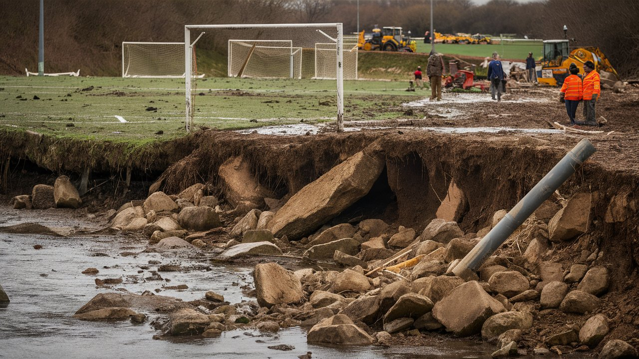
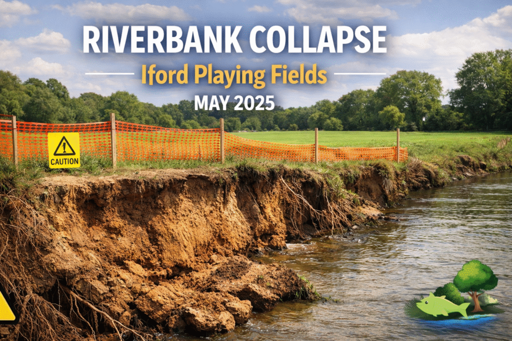
The story around Riverbank Collapse Iford Playing Fields quickly drew attention because it combined a dramatic visual scene with a very practical local concern. Local reporting indicated that trees collapsed into the river after an embankment gave way near Iford Playing Fields in Christchurch, turning what might have seemed like an ordinary stretch of riverside land into a place associated with instability, safety questions, and wider discussion about erosion near public green space.
That attention makes sense when the setting is considered properly. Iford Playing Fields is not an isolated strip of land with little public use. BCP Council lists Iford Playing Fields in Christchurch among its rugby pitch locations, while nearby Iford Meadows is described by the council as a local nature reserve next to the River Stour with grassland, scrub, wildlife value, and a remarkable range of flowering plants.
For readers, the importance of this topic lies in more than the collapse itself. A riverbank failure near sports ground, walking space, and a valued riverside environment raises questions about public safety, environmental pressure, local resilience, and what kind of repair or monitoring may be needed next. It also sits within a part of Dorset where river levels, flood warnings, and long-term flood management are already part of the public conversation.
What Happened at Iford Playing Fields
The core reported incident was simple but serious. Local reporting shared by the Bournemouth Echo stated that trees collapsed into the river after the embankment gave way near Iford Playing Fields in Christchurch. Even without a lengthy technical report in public view, that description tells readers a great deal. It suggests a physical failure of the river edge large enough to pull vegetation and mature trees downward, rather than a minor slippage of loose soil.
When trees go with a bank failure, the visual impact is immediate, but the structural meaning is important too. A bank that can no longer hold rooted trees has usually moved beyond superficial erosion. In practical terms, it means the edge has lost the strength needed to support the weight of soil, roots, and surface vegetation. That is why such incidents feel dramatic to residents even before any engineer or council officer publishes a formal assessment.
For content writers and readers alike, the key point is to frame the event clearly without overstating what is not yet confirmed. The publicly visible reporting supports the fact of an embankment giving way and trees collapsing into the river. Broader claims about the exact engineering trigger, soil mechanics, or repair budget should be treated cautiously unless and until an official statement spells those details out.
Why the Location Matters in Christchurch
Iford matters because the River Stour is not a remote watercourse passing through unused land. Government catchment data describes the Stour system as moving from rural reaches into the increasingly urbanised Bournemouth, Poole, and Christchurch area. That makes riverside instability near Christchurch different from erosion on a quiet agricultural edge, because the surrounding population, recreation use, and infrastructure pressures are much greater.
The local setting also carries community value. BCP Council’s information shows that Iford Playing Fields serves organised recreation through rugby pitches, while nearby Iford Meadows is recognised for wildlife and public enjoyment. That combination matters for search intent as well as public interest. People are not only asking what happened; they are asking whether a familiar place used for sport, walking, and outdoor leisure remains safe and stable.
Christchurch Harbour adds another layer of relevance. BCP Council notes that Christchurch Harbour combines the River Stour and River Avon and supports diverse birdlife and a broader riverside environment valued by walkers and visitors. A bank failure upstream or along connected public green space therefore resonates beyond one patch of damaged ground. It fits into a wider local landscape that people associate with nature, recreation, and the identity of Christchurch itself.
Understanding How Riverbanks Collapse
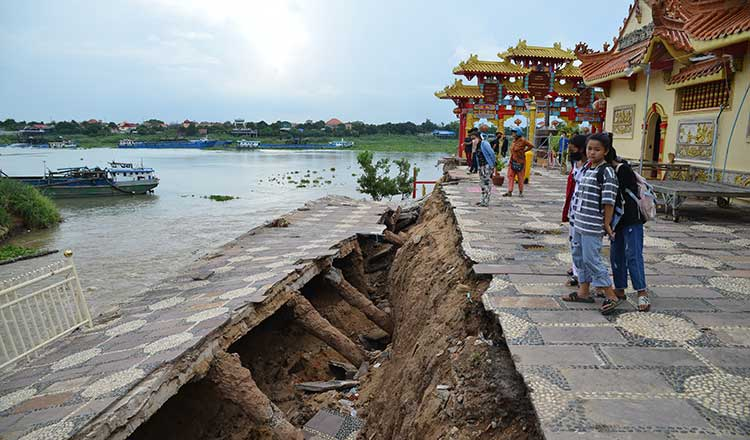
A riverbank collapse usually happens when the ground at the edge of the river can no longer resist the forces acting on it. Those forces may include flowing water eating into the toe of the bank, rainwater soaking into the soil from above, or the simple weight of saturated ground becoming too much for the slope to hold. Once the soil strength drops below the stress placed upon it, failure can happen quite suddenly.
Vegetation plays a surprisingly important role in holding river edges together. Guidance on restoring river banks notes that erosion becomes more likely when natural riparian vegetation has been depleted, while Wessex Rivers Trust explains that roots from marginal plants bind banks together and stems can slow water close to the edge. That means the stability of a bank is not just about mud and water; it is also about the living structure woven through the soil.
Not every collapse begins with one obvious cause. In many cases, riverbank failure is cumulative. Small amounts of erosion, repeated wet weather, slight undercutting by currents, pressure from high water, and gradual weakening around roots may all build toward a visible break. That is one reason these incidents can appear sudden to the public while actually reflecting a longer period of hidden deterioration.
The Role of Rain, High Water and Saturated Ground
Any discussion of a riverbank failure near the Stour has to acknowledge the wider flood context of the catchment. The Environment Agency’s Dorset Stour catchment flood management plan states that the catchment has a history of flood risk, with extensive flooding linked to high rainfall and prolonged wet periods. That broader history does not prove a specific trigger at Iford, but it does explain why saturated conditions are a credible part of the story.
The local flood service also shows why residents in the area are alert to river behaviour. The River Stour level at Iford Bridge includes thresholds for low-lying land flooding and property flooding, while the Lower Stour at Jumpers Common and A35 Iford Bridge area is an identified flood warning area. In other words, this is a landscape already monitored through the language of rising water, warnings, and risk management.
Recent regional weather and flood reporting reinforces that context. The Guardian reported flood alerts across England after Storm Chandra and noted that severe flooding warnings had affected the Lower Stour at Iford Bridge Home Park, with the Environment Agency warning that water levels remained high. Again, this does not independently confirm the precise cause of the playing fields collapse, but it strengthens the case for reading the incident within a wider period of hydrological stress.
Why Fallen Trees Make the Damage More Serious
When a bank failure pulls trees into the water, the damage is no longer only cosmetic. Trees tell us that the failed section involved depth, weight, and anchoring structure. Roots that once reinforced the bank are now exposed, displaced, or partly suspended. That often means the remaining edge nearby may also need checking, because the visible collapse can mark only the first stage of movement in an unstable section.
There is also a practical river management issue. Fallen trees can alter how water moves around the damaged area, trap debris, or redirect flow toward already weakened edges. In some settings, woody material can benefit habitat, but in a collapse zone beside public land it may also create hazards or complicate repair work. The important distinction is between natural woody habitat and sudden, destabilising tree loss caused by bank failure.
For readers, the phrase “trees collapsed into the river” is the part of the story that sticks in the memory. It transforms an abstract erosion incident into a scene people can picture. That is one reason the topic gained traction in search. It combines place, danger, and visual drama in one line, while also hinting that the damage may be more substantial than a casual glance at a muddy river edge would suggest.
Safety Concerns for Walkers, Families and Local Users
A riverside bank failure near public open space raises immediate safety questions, even before a full engineering inspection becomes public. The most obvious risk is the unstable edge itself. What appears firm from a few steps back can conceal fresh cracks, weakened turf, or undercut ground. After Riverbank Collapse Iford Playing Fields, the sensible public message is caution, because further slippage can occur after the first visible break.
The second issue is user diversity. Playing fields and nearby green spaces are used by walkers, sports participants, families, and visitors who may not read a landscape like an engineer would. A damaged river margin can be especially risky for children, dog walkers, and anyone approaching the edge for a better view. If trees have fallen and the surface has torn away, people may underestimate how much ground remains compromised.
There is also the question of temporary access management. In incidents like this, councils or land managers often need to consider barriers, warning signs, cordoned areas, or inspections before normal access feels responsible again. Even where the playing fields remain open in part, the affected riverside section may need to be treated as a live hazard zone until monitoring shows the bank has stabilised or repair work has been completed.
Impact on Residents, Sport and Daily Routines
Public incidents on river edges matter partly because they interrupt ordinary life. Iford Playing Fields is not just scenery; it is a functional recreational space. When people hear that a bank near a familiar field has given way, they immediately think about whether matches, walks, shortcuts, dog routes, or weekend outings will be affected. Search traffic often reflects this everyday concern more than abstract interest in geomorphology.
Nearby communities also interpret such events through memory. In areas where flood warnings and rising water have already featured in local experience, a visible bank collapse can feel like confirmation that the landscape is under pressure. The Environment Agency’s long-term flood planning for the Dorset Stour and the identified Iford Bridge warning areas help explain why residents may read one collapse as part of a larger pattern rather than as an isolated curiosity.
Sporting use can be affected even when pitches themselves remain usable. River-edge access routes, spectator movement, maintenance logistics, and perceptions of safety all influence whether a site feels normal. The damage can therefore produce a wider psychological effect than the physical footprint alone suggests. In local SEO terms, that is why readers search for updates, response, and future risk rather than simply for a one-line description of what happened.
Environmental Consequences for the River Stour Corridor
The environmental dimension is easy to overlook when the dramatic image is a collapsed tree, but it matters greatly. Wessex Rivers Trust notes that siltation can reduce water quality, diminish spawning success for fish, and reduce the diversity of aquatic invertebrates. When a bank failure sends soil into the river, the effect is not only on appearance. It can alter clarity, habitat condition, and the ecology of the immediate river margin.
This is especially relevant in a catchment valued for wildlife. BCP Council describes Iford Meadows as rich in birds and flowering plants, while Christchurch Harbour is presented as a diverse bird habitat, and catchment data identifies statutory environmental designations within the broader Stour system. That context means riverside damage is not merely a maintenance headache; it sits within a living corridor already recognised for ecological importance.
At the same time, good restoration should avoid turning every river edge into a sterile engineered wall. Modern river thinking often tries to balance stability with habitat function. In some places, natural vegetation, graded banks, and bioengineering approaches can support both erosion control and ecological health. The challenge after a public-facing collapse is to repair risk without stripping the riverbank of the qualities that made the area valuable in the first place.
How Councils and Agencies Usually Respond After a Bank Failure
The first stage of response is usually site safety and inspection. Before long-term design begins, land managers need to establish whether the bank is still moving, whether public access needs restricting, and whether the collapse threatens adjacent land use. In a place close to playing fields and public paths, that initial control phase can be as important as the later engineering, because it prevents curiosity from turning into injury.
The next stage is diagnosing why the failure happened. Was the toe of the bank eroded by flow, was the slope over-steepened, did saturated ground lose strength, or had vegetation structure already been weakened over time? Restoration guidance makes clear that repair choices depend on site conditions and source pressures. A bank that failed from one-off undercutting may need a different solution from one weakened by long-term vegetation loss or repeated wetting.
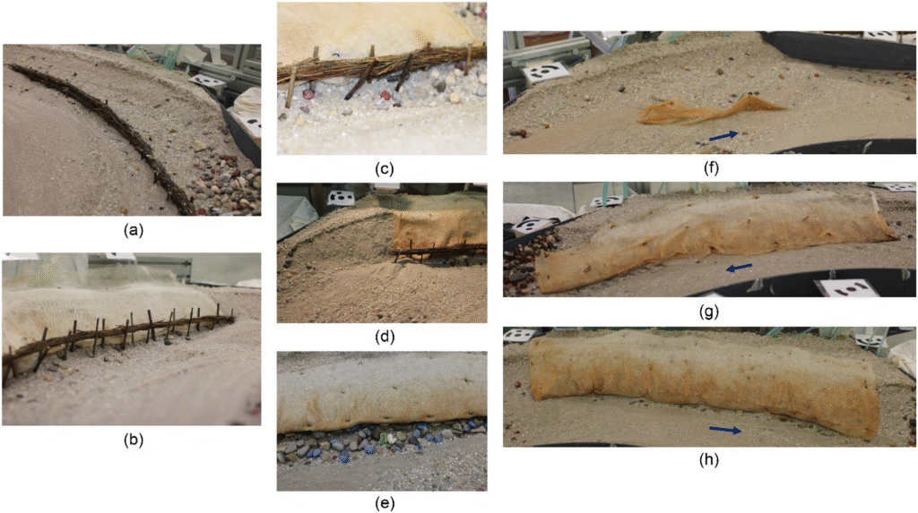
Finally comes the choice between short-term and durable repair. Temporary measures can include fencing, selective tree management, and protection around the most fragile ground. Longer-term options may involve regrading, planting, bank reinforcement, or softer stabilisation methods that work with natural processes. The best outcome is normally not the fastest-looking fix, but the one that reduces future erosion while preserving public use and environmental value.
Could It Happen Again
This is the question that often matters most to readers, and it deserves an honest answer. Yes, any riverbank section that has recently failed can raise concern about adjacent instability, especially if the original causes remain active. That does not mean another dramatic collapse is inevitable tomorrow, but it does mean the incident should be understood as a warning sign rather than as a self-contained event that automatically ended the moment the trees fell.
The answer also depends on weather and river conditions. In catchments with a history of flood pressure and prolonged wet periods, future rainfall can continue to test already weakened edges. The Dorset Stour flood planning documents and current flood warning frameworks show that this is a river system long managed with future risk in mind. Stability is therefore not a one-time yes-or-no judgement; it is an ongoing condition shaped by water, land use, and maintenance.
What readers should take from this is balance, not alarm. A collapse does not automatically mean the entire riverside landscape is about to fail, yet it does justify scrutiny of nearby ground and continued public caution. Sensible monitoring, clear communication, and appropriate repair can reduce the chance of repeat failure, but complacency is rarely a good strategy on a river edge that has already shown visible weakness.
Why the Story Gained Search Attention Online
Search interest often reveals what readers really care about. In this case, the topic performs well because it combines a precise place name, a dramatic physical event, and a clear public-safety angle. Riverbank Collapse Iford Playing Fields is exactly the kind of keyword phrase people type when they want immediate clarity. They are looking for what happened, whether the area is safe, how serious the damage is, and what the authorities may do next.
The wording also has strong local-search value. “Iford Playing Fields” anchors the story to a recognisable Christchurch location, while “riverbank collapse” captures the unusual and alarming part of the event. Because the phrase is specific rather than generic, it attracts readers with focused intent. That kind of specificity is often useful for UK local SEO, especially when audiences want a clear incident explainer rather than a broad article about erosion in theory.
Another reason for traction is that the incident sits inside a wider pattern of public concern about the Stour corridor, flooding, and environmental pressure in the Bournemouth and Christchurch area. Official flood pages, catchment planning documents, and wildlife descriptions all show a landscape where water, ecology, and human use are tightly connected. A local collapse therefore becomes part of a bigger conversation, which naturally sustains reader interest beyond a single news cycle.
What Readers Should Watch Next
The next developments that matter most are the ones that change daily reality on the ground. Readers will want to know whether access has been restricted, whether inspections have identified continuing instability, and whether any repair timeline has been announced. These are the updates that transform a story from raw incident coverage into a useful public resource. In local search, practical updates often outperform vague commentary.
It is also worth watching for the language authorities use. Terms such as erosion, slippage, undermining, toe failure, saturated ground, or stabilisation can signal how seriously the site is being treated. Even when no dramatic new imagery appears, those technical clues matter. They help readers understand whether the issue is being managed as a short-term cleanup job or as a more involved bank-restoration challenge.
Beyond the immediate site, weather and river conditions remain relevant. If local flood warnings intensify or the Stour experiences another period of elevated levels, public concern around the damaged area is likely to rise again. That is why the best follow-up coverage will not only repeat the original incident description but also connect it to river behaviour, access advice, and long-term resilience planning across the Christchurch stretch of the catchment.
Conclusion
The incident near Iford Playing Fields matters because it sits at the meeting point of landscape, public space, and river risk. Local reporting described trees collapsing into the river after an embankment gave way, and that single image captured why the story spread so quickly. It was not just about mud or damage. It was about a familiar Christchurch setting suddenly appearing unstable and vulnerable.
Seen in full context, Riverbank Collapse Iford Playing Fields is part of a wider story about how riverside environments function under pressure. The Stour catchment has a long flood-risk history, the Iford area is part of an actively monitored flood landscape, and the surrounding green spaces hold both recreation value and ecological significance. Those factors make the collapse more meaningful than a one-day local curiosity.
For readers and writers alike, the strongest approach is clear, grounded, and useful. Explain what has been reported, place the incident within the River Stour context, acknowledge uncertainty where official technical detail is absent, and focus on the real questions people have: safety, stability, repair, and what happens next. That is the route to a strong article and, more importantly, to trustworthy local coverage.
FAQs
What happened in the Riverbank Collapse Iford Playing Fields incident?
Local reporting indicated that an embankment gave way near Iford Playing Fields in Christchurch and that trees collapsed into the river. Publicly accessible official technical detail appears limited, so the safest summary is that a visible section of riverside ground failed in a way serious enough to pull trees down with it and trigger wider concern about stability and safety in the area.
Where is Iford Playing Fields located?
Iford Playing Fields is in Christchurch within the Bournemouth, Christchurch and Poole area. BCP Council identifies it as a Christchurch sports location with rugby pitches, and nearby Iford Meadows is described as a local nature reserve next to the River Stour. That means the site sits within a riverside landscape used for recreation and valued for nature, not in an isolated or little-used setting.
Why did the riverbank collapse near Christchurch?
No publicly accessible official explanation in the sources reviewed sets out a final technical cause for this specific site. However, general riverbank guidance shows that collapses can be linked to erosion at the waterline, saturated soil, loss of vegetation strength, and prolonged wet conditions. In the Stour catchment, flood history and wet-period pressures make those mechanisms plausible background factors.
Is Iford Playing Fields safe to visit after the collapse?
Caution is the sensible answer. After any bank failure, the visible damage may not reveal the full extent of instability, and fresh cracks or undercut ground can remain hazardous. People should rely on current local access arrangements, warnings, or barriers and avoid approaching damaged edges simply to inspect the scene. Riverbank failures are most dangerous when curiosity draws people too close to weakened ground.
Could more of the riverbank collapse in the future?
It is possible, although not certain. A recent failure can indicate that nearby ground has also been stressed, especially where wet weather, erosion, or slope weakness are still present. That is why inspection and monitoring matter. A collapse does not automatically mean a chain reaction will follow, but it does justify careful management until the site is assessed and any stabilisation measures are completed.
How does a riverbank collapse affect the environment?
The main environmental impact is often sediment entering the river. Guidance from Wessex Rivers Trust explains that siltation can harm water quality, reduce spawning success for fish, and lower aquatic invertebrate diversity. If the damaged area also loses vegetation, the river margin may become more vulnerable to continued erosion until roots, plants, or restoration measures help rebuild stability.
What are authorities likely to do after a collapse like this?
Typical response includes inspection, public-safety management, and then decisions about repair. Depending on site conditions, that can mean barriers, warnings, selective removal of unstable material, regrading, planting, or more structured bank reinforcement. Good practice usually focuses on matching the repair method to the actual cause and trying to reduce future erosion without unnecessarily damaging habitat value.
Why is this topic getting so much attention online?
The subject attracts attention because it combines a local place people recognise with a dramatic and easy-to-picture event. Riverbank Collapse Iford Playing Fields sounds urgent, specific, and relevant to safety, recreation, and community life. That combination tends to perform well in search because readers want more than headline shock. They want a practical explanation of damage, risks, and likely next steps.
You may also read:Finding the Right Food for Your Needs