
Why this story captured so much attention
When readers searched for UK Bracing for a 411-Mile Snowstorm Ahead of Christmas, they were reacting to a headline formula that blends three irresistible elements: scale, timing, and disruption. A storm described as stretching 411 miles sounds enormous, Christmas adds urgency, and the promise of weather maps turning orange gives the story a visual hook that feels immediate and dramatic. That combination helps explain why the phrase spread quickly across news-style websites and search results.
The reports that drove this headline were largely built around model graphics and forecast interpretations circulating in late November 2024. Several write-ups pointed to a projected cold spell between November 30 and December 9, with December 7 highlighted as the key day for snow flurries and worsening travel conditions. Areas such as Newcastle, Cumbria, Northumberland, and Greater Manchester were repeatedly mentioned as places most likely to feel the effects if the projected band of wintry weather developed as shown.
What made the topic especially clickable was that it sat right after an already unsettled period in the UK. The Met Office later looked back on the 2024/25 storm season and confirmed that late November had already been shaped by Storm Bert and Storm Conall, which brought heavy rain, strong winds, and some snow. In that context, audiences were primed to believe that another major system could arrive in early December and create another difficult travel period before the festive season.
The forecast behind the 411-mile headline
The heart of the story came from forecast maps and secondary reporting rather than from an official Met Office statement describing a “411-mile snowstorm” in those exact words. Reporting accessible through outlets summarising WXCharts projections said a snow band about 411 miles wide could affect large parts of the UK, with December 7 presented as the most likely peak date for flurries and deteriorating conditions. Some reports also framed the event as lasting around 60 hours, which added to the sense that this could be more than a brief passing shower.
That matters because weather headlines often compress a complex forecast into a single dramatic image. A coloured weather chart can suggest a clean, nation-spanning snow event, but operational forecasting is more nuanced. Snow depth, duration, and actual ground-level impact depend on temperature profiles, local topography, wind direction, and whether rain turns to sleet or snow as a front moves through. Even when models show broad wintry potential, the real-world result can vary sharply from one region to another and from higher ground to lower ground.
For SEO readers, that distinction is important. The phrase UK Bracing for a 411-Mile Snowstorm Ahead of Christmas works as a search term because it sounds precise, but the underlying forecast was always probabilistic rather than guaranteed. Model-driven reporting can be useful for spotting risk windows, yet the official warning system remains the more reliable guide when people need to decide whether to travel, delay deliveries, or change plans. That is why the smartest reading of the headline is not “certainty,” but “heightened possibility of disruptive winter weather in early December.”
Which parts of the UK were expected to be hit hardest
The areas most often singled out in accessible reporting were Newcastle, Cumbria, Northumberland, and Greater Manchester. Those locations appeared repeatedly in summaries of the projected snow band, suggesting that northern England and adjoining exposed zones were in the conversation from the beginning. The reason this pattern sounded plausible is straightforward: colder air moving south, upland exposure, and transport corridors linking northern cities can all increase concern when snow is even a moderate possibility.
At the same time, the official Met Office messaging in early December 2024 did not reduce the risk story to one simple snow map. On December 2, the Met Office said colder northerly winds would bring a likelihood of some snow over higher ground in Scotland and northern England, alongside frost and other wintry hazards. By December 4, the focus widened to a series of low-pressure systems bringing very wet and windy weather, with snow mainly over the highest ground in Scotland and a growing risk of disruptive wind and rain elsewhere.
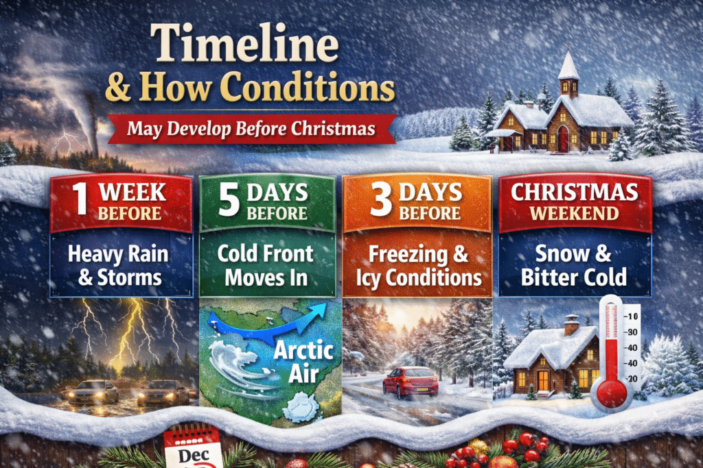
This means the geographic story was really two stories layered together. The media-friendly version emphasized a sweeping snow band across a large stretch of the country, while the official picture pointed to a broader multi-hazard setup involving wind, rain, some hill snow, and colder air pushing south after unsettled conditions. If you were reading the maps at the time, the most accurate takeaway was that northern and higher areas looked most wintry, but the whole UK faced some level of weather-related disruption risk as the first full week of December unfolded.
What official warnings said as the weather moved closer
A major reason this topic deserves careful treatment is that official warnings evolved as the event approached. On December 4, the Met Office warned that the UK would be affected by a series of low-pressure systems through the second half of the week and into the weekend, bringing very wet and windy weather for some. It also noted the possibility of gusts up to 80 mph around western coasts and heavy rain totals in parts of Wales and northern England, while colder northerly air was expected to return behind the system.
By December 5, the storm in question had been named Darragh in the official UK storm season list, with impacts dated to December 6 and 7. On December 7, the Met Office said Storm Darragh was bringing very strong winds, heavy rain, and some hill snow, and that a red warning for wind had been in force for parts of Wales and areas around the Bristol Channel. Reported gusts included 93 mph at Capel Curig and 92 mph at Aberdaron, which shows that the most severe verified hazard in the official record was wind rather than blanket lowland snowfall across the entire country.
That shift is exactly why readers should treat dramatic snowstorm phrases with caution. The early December danger was real, but the official danger profile was broader and, in some regions, more severe for wind and rain than for snow. In practical terms, a commuter in an exposed coastal or western area may have had more reason to fear falling trees, power cuts, and travel cancellations than deep settled snow. The headline made snow the hero of the story, while the formal warnings framed the event as a wider severe-weather episode.
Why weather maps often create dramatic snow narratives
Weather maps are powerful because they simplify complexity into colour. An orange or white band across a national map looks decisive, even when the underlying model still contains uncertainty about temperature, elevation, or timing. That is why phrases like UK Bracing for a 411-Mile Snowstorm Ahead of Christmas travel so well on search and social platforms. They translate a technical forecast into a story people can immediately imagine: roads blocked, trains delayed, flights disrupted, and Christmas plans suddenly under threat.
But snow forecasting is especially vulnerable to overstatement at longer lead times. A small temperature change can turn projected snow into rain, or shift meaningful accumulation away from major towns and into higher ground. The Met Office’s own white Christmas guidance makes this caution clear in a different context by stressing that snow likelihood can only be forecast accurately close to the day itself. That principle applies more broadly to festive snow chatter: forecast confidence grows as the event nears, and headlines written too early often sound more certain than meteorology allows.
This does not mean model maps are worthless. They are useful signals, especially for professionals, enthusiasts, and anyone watching the trend from run to run. The problem begins when a projection becomes a promise. Good weather journalism explains what is likely, what is possible, and what remains uncertain. Great weather SEO content does something even more valuable: it turns a dramatic keyword into a balanced guide that helps readers understand risk without mistaking forecast imagery for a guaranteed outcome.
Did this mean the UK was heading for a white Christmas
Many readers naturally jump from an early December snow headline to the idea of a white Christmas. In Britain, those two ideas feel emotionally linked, but meteorologically they are not the same thing. The Met Office says a white Christmas officially requires only a single snowflake to be observed somewhere in the UK during the 24 hours of December 25, and it also notes that Christmas Day snow can only be forecast accurately a few days beforehand. That means an early December cold spell, even if disruptive, does not automatically predict snowy scenes on Christmas morning.
This is one of the most important clarifications for anyone searching UK Bracing for a 411-Mile Snowstorm Ahead of Christmas. The phrase suggests a direct line from a large early-December storm to festive snowfall, yet official Christmas-week guidance in 2024 pointed in a calmer direction. On December 18, the Met Office said Christmas Day itself was likely to be settled, often cloudy, dry for the majority of the UK, and widely mild, with the far north more likely to stay windier and perhaps wetter. That outlook was not consistent with the idea of a countrywide snowy Christmas scene.
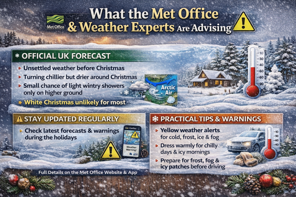
The wider lesson is that British weather near Christmas is driven by evolving air masses and the jet stream, not by a single earlier headline. Snow in the first week of December may create a powerful festive mood, but it does not settle the question of conditions on December 25. For readers and publishers alike, it is smarter to separate “a potentially wintry start to the month” from “a white Christmas forecast.” Mixing the two can generate clicks, but it also confuses what the science is really saying.
Why travel concerns were central to the story
The moment a large pre-Christmas storm is mentioned, travel becomes the real public concern. In the UK, the festive period concentrates road journeys, rail movements, airport pressure, retail logistics, and courier demand into a narrow window. That is why the phrase UK Bracing for a 411-Mile Snowstorm Ahead of Christmas resonated beyond weather enthusiasts. Even people who do not normally follow forecast charts understand that poor conditions in early December can ripple through commuting, shopping, school routines, and travel planning for weeks.
Official guidance in early December 2024 backed up those concerns, although again not always for snow alone. The Met Office warned of strong winds, heavy rain, and some snow over higher ground, and it explicitly highlighted the potential for transport challenges. Later Christmas-week guidance also warned that gusty, wet conditions in the run-up to the holiday period could cause delays or cancellations to sea and air transport in northern and western areas. In other words, the travel-risk theme was justified, but the disruption picture was wider than a simple snow-only headline implied.
For drivers, the Met Office winter travel advice is plain and practical. Roads can become tricky due to snow, ice, heavy rain, and strong winds; travellers are advised to plan journeys, slow down, leave more room for stopping, avoid harsh braking, and stay alert to rapidly changing conditions. In heavy snow and ice, the guidance is even firmer: avoid travel if possible, allow much more stopping distance, and use gentle manoeuvres to reduce the chance of skidding. These are not dramatic tips, but they are the advice that matters most when headlines begin to escalate.
How households could prepare without panicking
A sensible household response to a story like this is preparation without hysteria. The Met Office’s broader WeatherReady advice encourages people to stay updated, understand local warnings, and take manageable steps before bad weather arrives. In winter, that means checking forecasts regularly, preparing for changes in travel time, and recognising that disruption is often caused by a mixture of hazards rather than by snow depth alone. High winds, poor visibility, standing water, and icy patches can all become serious issues even when snow totals are lower than an alarming headline suggested.
Vehicle readiness is another practical layer that often gets overlooked in click-heavy storm coverage. Met Office-linked winter advice recommends planning ahead and carrying the right essentials. Drivers are encouraged to keep enough fuel, make simple vehicle checks, and prepare for delays that may arise in cold or wintry conditions. Separate guidance on winter car kits highlights basics such as keeping windscreens clear and having useful equipment in the boot in case a journey becomes longer or more difficult than expected.
When strong winds become part of the story, home safety matters as much as road safety. Met Office advice says people should secure loose outdoor items, stay indoors as much as possible during severe winds, avoid sheltering near buildings or trees, and never go outside mid-storm to attempt repairs. This is an important reminder because early December 2024 officially became a severe wind event in several places. Readers who interpreted the situation only as a snow story risked overlooking one of the most immediate and dangerous parts of the forecast.
What early December 2024 actually looked like in context
To understand the headline properly, it helps to view it inside the sequence of weather events that surrounded it. Late November 2024 had already been unsettled, with Storm Bert bringing heavy rain, strong winds, and snow, and Storm Conall following closely behind. The Met Office later described Bert as a multi-hazard event and noted that the run of storms had already compounded impacts across the UK. That background helps explain why another projected weather hit in early December seemed both plausible and threatening to readers.
Then, in the first week of December, official attention moved toward Storm Darragh, which was named on December 5 and affected the UK on December 6 and 7. The Met Office record for that period emphasised very strong winds, heavy rain, and some snow over higher ground, with multiple warnings in force and very high gusts measured in Wales. So while the “411-mile snowstorm” headline captured a strand of the forecast conversation, the verified event ultimately sat within a broader severe-weather episode dominated in many places by wind impacts.
That dual reality is worth spelling out because it improves both accuracy and reader trust. The search phrase was not invented out of nowhere; it reflected genuine concern about wintry conditions and model signals for early December. However, the most responsible interpretation is that the UK faced a large-scale unsettled spell with regionally variable hazards, not a simple nationwide certainty of deep snow from south to north. In SEO writing, nuance can feel less flashy, but it usually produces content that lasts longer and satisfies readers more completely.
Why this keyword performs so well in UK search
From a content strategy perspective, this keyword is powerful because it combines a location, a number, a weather threat, and a festive time cue in one line. UK-based readers searching it are likely looking for several things at once: whether the forecast was real, which places were at risk, what date mattered most, whether Christmas travel would be affected, and whether weather maps backed up the warning. A strong article meets all of those intents in one place instead of repeating the headline without context.
The best way to rank with a topic like this is not simply to sound dramatic. It is to sound useful. That means clarifying that the 411-mile language came from reporting around forecast maps, identifying the repeatedly named areas, distinguishing projections from official warnings, and explaining what later happened in the verified Met Office timeline. It also means addressing the question many readers silently carry: whether such a forecast actually pointed toward a white Christmas. When an article answers those connected questions well, it becomes more than a title match and starts to satisfy real search intent.
In practical SEO terms, content on weather stories tends to perform best when it blends immediacy with authority. A sensational phrase can pull readers in, but authority keeps them on the page. That authority does not require a dry tone. It requires structure, clear explanations, and evidence-based framing. For this topic, the most effective article is one that acknowledges why the headline exploded, then calmly explains what the forecasts suggested, what official agencies warned about, and what readers should have understood from the difference between the two.
The bigger takeaway from the snowstorm headline
If there is one final lesson from UK Bracing for a 411-Mile Snowstorm Ahead of Christmas, it is that the strongest weather headlines often mix genuine risk with compressed storytelling. There really was an unsettled and potentially disruptive early December setup. There really were forecasts highlighting snow risk for northern and higher areas. And there really were official warnings as the week advanced. But the national picture was more complicated than the clean, dramatic phrase many readers first encountered.
For readers, the smart habit is simple: enjoy the maps, but trust the warnings. Forecast graphics are excellent for spotting patterns and getting an early sense of what might develop. Official guidance is what should shape decisions on travel, school runs, shopping plans, outdoor work, and safety steps around the home. The difference matters because winter impact in the UK is rarely about one variable alone. Wind, rain, frost, ice, and snow interact, and even a storm remembered mainly for a snow headline may end up causing more trouble through another hazard entirely.
For publishers and content creators, the message is just as clear. A successful article on this topic should not merely recycle the phrase UK Bracing for a 411-Mile Snowstorm Ahead of Christmas. It should decode it. The most useful content explains where the phrase came from, which areas were highlighted, what the official record showed, and why a large snow headline ahead of Christmas does not automatically equal a white Christmas or a nationwide shutdown. That kind of article does more than chase clicks. It earns trust, and trust is what keeps a page valuable long after the first weather panic fades.
FAQs
What does the 411-mile figure actually mean?
The 411-mile figure came from reporting around forecast map projections that described a very large band of wintry weather stretching across a broad part of the UK. It was a way of visualising scale rather than an official Met Office label for the event. In other words, it helped create a memorable headline, but it should be understood as part of forecast coverage, not as a formal storm classification used by the UK warning system.
Was the whole UK expected to get heavy snow?
No. Reports repeatedly pointed to parts of northern England such as Newcastle, Cumbria, Northumberland, and Greater Manchester, while official Met Office updates discussed colder conditions, some snow over higher ground, and then a wider period of wet and windy weather. The risk was real, but the most likely impacts varied by region, elevation, and timing. Blanket lowland snow across every part of the UK was never the most accurate way to summarise the official warning picture.
Did this forecast mean there would be a white Christmas?
Not necessarily. The Met Office says a white Christmas officially means a single observed snowflake somewhere in the UK on December 25, and it also says that snow on Christmas Day can only be forecast accurately a few days in advance. In fact, by December 18, 2024, the Met Office was indicating that Christmas Day itself was likely to be settled, often cloudy, dry for most places, and widely mild rather than snowy across the country.
What was the official severe weather story in early December 2024?
The official record shows that Storm Darragh was named on December 5 and affected the UK on December 6 and 7. The Met Office described the storm as bringing very strong winds, heavy rain, and some hill snow, with a red warning for wind in parts of Wales and areas around the Bristol Channel. So although snow headlines dominated some search results, the most severe verified impacts in many places were linked to wind and broader severe-weather conditions.
How should people respond to headlines like this in future?
The best response is to use such headlines as an early alert, not a final verdict. Check official local warnings, review travel advice, prepare a vehicle for winter, and secure outdoor items if strong winds are possible. Met Office guidance for snow, wind, and winter travel consistently emphasises planning, caution, and staying updated because conditions can change quickly and the most disruptive hazard is not always the one that dominates the headline.
You may also read: Why the Fine Reached £7,692